
Leaving our mark across Texas for over 20 years!
Leaders in
Landesign
Land Surveying for public and private agencies

Premier surveying and land development solutions firm
For public and private projects across Texas
celebrating 20 years
Setting the standard for tech, expertise, and quality results
At Landesign Services, Inc. we embrace change as an opportunity, so we consistently invest in ongoing education and the latest technology to deliver innovative solutions and premium land survey products.
Trusted SBE for TxDot
HOW WE WORK
Right the first time, every time.
We have our eyes set on the bigger picture and the smallest details for every land survey. We don’t cut corners, but combine the latest technology and our extensive expertise to save you time and money.
- Public Works
- Private Development
- Geospatial Services
Boundary & Title Surveys
From conventional boundary and title surveys to more complex ALTA/NSPS Land Title Surveys
Topographic Land Surveys
Plan for roads, bridges, and buildings with accurate maps of physical features and existing conditions
Hydrographic & GPS Surveys
Our specialized equipment and satellite-based technology delivers precise maps of land or water
Construction & Design Surveys
Get detailed maps and measurements for your construction project before and during your build
Subdivision Platting
Map an accurate division of land and lots with boundary and topographic surveys for plat prep
Floodplain Mapping
Know where your property or development is at risk of flooding and other factors that affect water flow
A Reputation for Excellence
Word gets around and we work with everybody – engineers, developers, city, county, state, and federal partners.
innovative solutions
Our Tech Advantage
Employing game-changing innovations and expert land surveyors for high-profile projects
LiDAR
We provide detailed maps of the earth using the latest terrestrial, mobile, and airborne LiDAR sensors. This technology expedites acquisition, keeps our crews safe, and enable us to create the most accurate geospatial model of the project so our clients start with the best, most accurate data.
Photogrammetry
Create 3D land models with aerial and ground-based images for land use planning or environmental management. We're setting the standard for quality with the latest softcopy stereo photogrammetric technology to support engineering design, infrastructure, oil and gas, GIS base mapping, environmental studies, and land development.
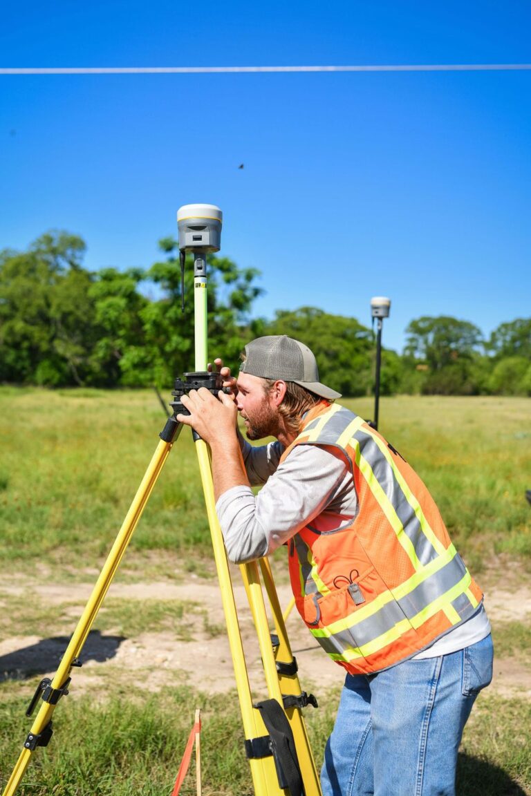
GNSS & Total Stations
Secure precise position and orientation measurements using advanced robotic total stations like the sx10 and GNSS GPS systems. Our cutting-edge technology provides real-time data and ensures high levels of accuracy for the most complex projects.
Drones
Get the latest UAV technology for aerial photography and mapping, airborne LiDAR, floodplain mapping and analysis, land assessments, and 3D modeling. Our commitment to cutting-edge technology for a premium land survey doesn't stop at the point of purchase. We employ expert-level UAV pilots dedicated to the mastery of drone advancements.
servant leaders
A Team You Can Trust
At our core, we’re a company dedicated to excellence and elevating the development experience for all the people and organizations our land surveys impact. As leaders, it means setting our team up for success. As business owners, it’s honoring the reputation we’ve earned.
Testimonials
What Our Clients Say
Our success is a collective effort that includes our staff and our partners. We value every relationship as an integral part of our company. See what our partners have to say.
Contact Details
Get in touch to begin work on a land survey solution for a new construction, civil engineering, or land development project.